
Private Property
Property boundaries are constantly changing, and it would be impossible for us to continually check every single entry we have listed on our web site. Adventure respectfully, and responsibly; check land ownership prior to departing! This is a free online resource, and you assume all liability and risk for using the information on our web site.
Permission from a land owner is almost always required unless the location is on crown or public land, or signage stating otherwise is posted. There is no "right to roam" in Canada. Just because a springs exists, does not mean it is necessarily open for public use!
Native bands have become increasingly energetic about prohibiting unauthorized non-band members. This is likely due to abuse of the sites and surrounding areas. If you do obtain permission from a land owner, always treat the location with respect. Leave it in the same condition as when you arrived.
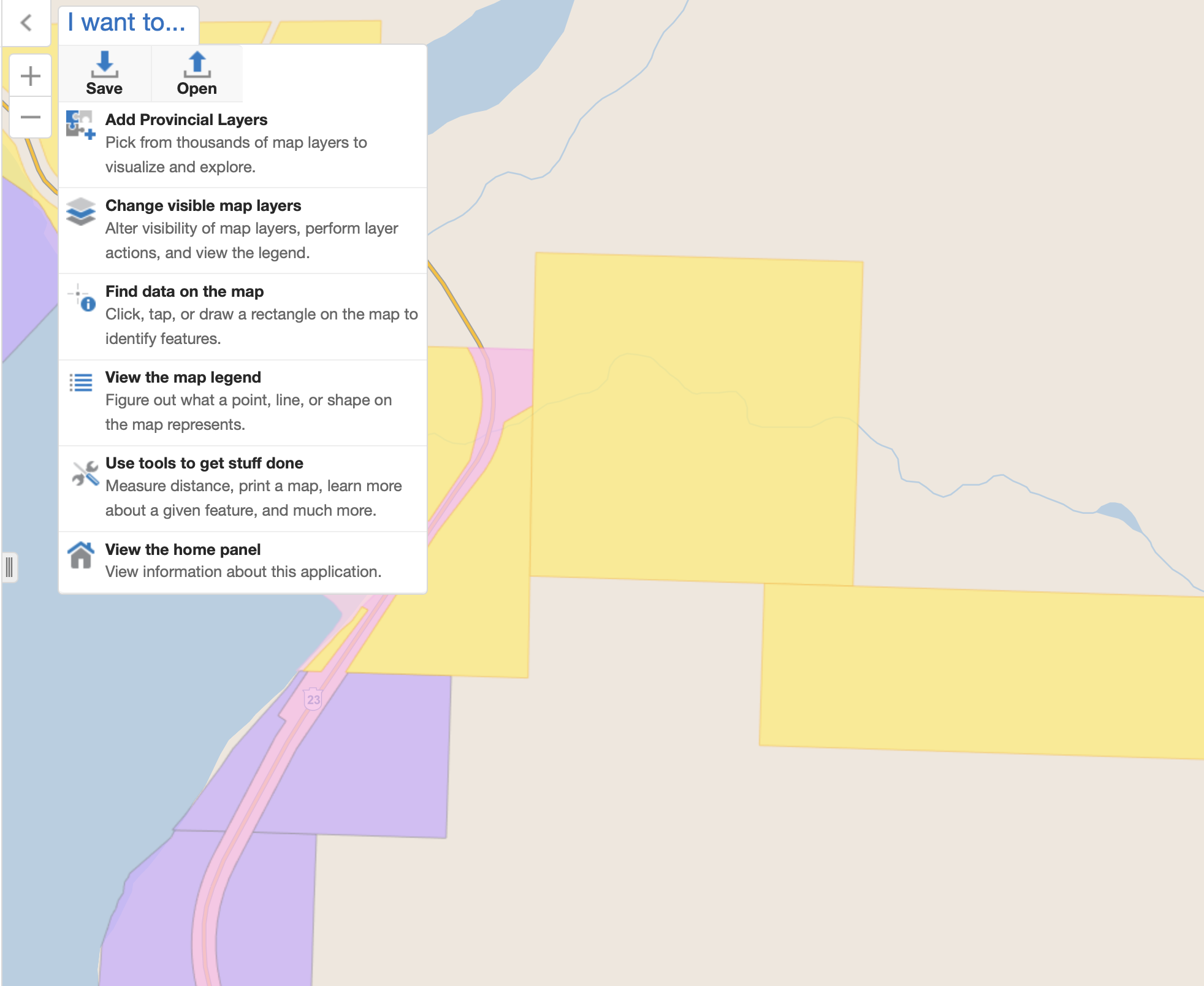
Use iMapBC and adventure SMART!
-
Visit iMapBC's web site: https://maps.gov.bc.ca/ess/hm/imap4m/
-
Click "Add Provincial Layers" from the "I want to..." drop down.
-
Add the correct layer by navigating as follows:
-
Land Ownership and Status, and then:
-
ParcelMap BC Parcel Fabric Cadastre - By Owner Type, and then:
-
PMBC Parcel Cadastre By Owner Type
-
-
Zoom in and the map will now be color coded. Click a colored zone for more information. Currently, yellow zones are private property and should not be accessed without permission from the land owner.
Here's an example from Peachland. If you'd like to contact the owner, title searches can be done relatively cheaply via Land Titles BC online using the PID number from iMapBC.